

Croker Hill [Sutton Common]
Good walks are even better shared.
SJ9367 : Private road leading up to Croker Hill
Colin Park Photo source
Overview
Croker Hill [Sutton Common]
Croker Hill, standing at a modest elevation of 250 meters, boasts the title of a Marilyn due to its relative prominence within the Cheshire landscape. Located near SJ933676, this inviting hilltop is a favourite amongst locals and visitors alike.
Geology
Crokers' geology tells a tale of glacial activity, with sandy soil underfoot created by thousands of years of natural processes. The mix of glacial till supports a variety of grasses and wildflowers, making it a wonderful habitat for wandering wildlife.
The Routes
One popular path is the Sutton Common Circular Route, which stretches about 5.5 km and should take roughly 2 hours to complete. It’s a moderate route that offers just the right amount of footwork to justify a few biscuit stops along the way.
Summit Features
As you climb, you’ll be greeted by a small yet friendly cairn at the summit, along with a handy wooden bench where you can plop down and enjoy the view. It’s the ideal spot to catch your breath – and perhaps a few seagulls trying to swipe your sarnies!
Terrain Type
Expect predominantly grassy terrain with some rocky outcrops showing off their rugged charm. Keep an eye out for patches of vibrant heather during summer months; it’s like nature’s confetti!
Scenic Views
From the top, your reward is stunning views of the Wrekin and the undulating Shropshire Hills. On especially clear days, you may even spot the distinctive peaks of the Welsh mountains peeking over the horizon. Spring and summer are the best seasons for clear visions, as landscapes burst into life with colour.
Hazards
It's important to watch your step; the paths can get a bit uneven, and after rain, they can turn into a slippery slope—so no need to channel your inner stunt double!
Nearby Summits
A short jaunt away is Mow Cop, offering another excellent hike that contrasts nicely with Croker Hill.
Access
If you’re travelling by car, there’s a free car park at the village of Sutton, just a short jaunt from the trailhead. For those relying on public transport, the nearest train station is Congleton, around 8 km away, with bus services to Sutton that make life easy.
Facilities
Congleton has several charming cafes, perfect for taking a break and fortifying yourself with some local treats before or after your hike.
History
The name 'Croker' hints at a storied past, evoking images of croaking water birds once gracing these lands. Croker Hill has not just been a natural marvel but a cultural touchstone for families enjoying picnics and sheep farmers tending to their flocks for centuries.
Whether you’re after a peaceful hike or a heart-pumping trek, Croker Hill [Sutton Common] welcomes you, ready to share its beauty and a touch of humour with every step you take!
Explore routes near Croker Hill [Sutton Common]
Walks starting near this hill. Open a route to check its map, distance and full itinerary.
Three Shires guided hike
View route
Rudyard Lake Circuit near Leek
View route
Tittesworth Reservoir
View route
Deep Hayes Country Park: Cumberledge Pool and woodland circuit
View route
Route planning notes
These notes describe possible approaches. Check a route's map and access information when planning your walk.
Sutton Common Circular Route
A popular loop starting from the village of Sutton, showcasing scenic views and varied terrain.
Make a day of it, together
Find someone to share the walk with, or organise a day out along a route you like.
Photo Gallery
View all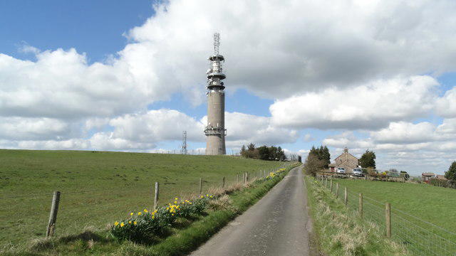 Photo could not load
SJ9367 : Private road leading up to Croker Hill
Colin Park
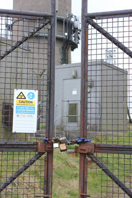 Photo could not load
SJ9367 : Telecoms tower access point
Peter Turner
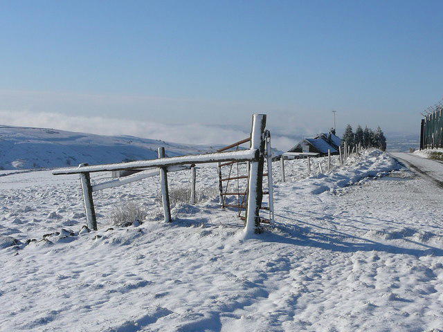 Photo could not load
SJ9367 : Winter on Sutton Common
Colin Park
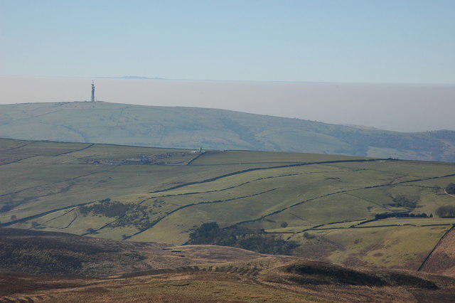 Photo could not load
SJ9367 : Sutton Common BT Tower
Philip Halling
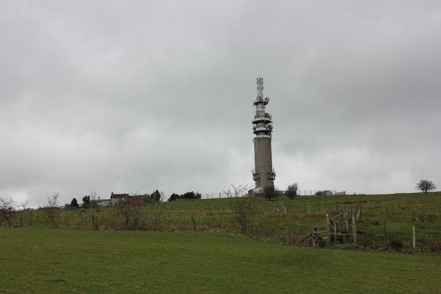 Photo could not load
SJ9367 : Sutton Common Telecoms tower and Lingerds Farm
Peter Turner
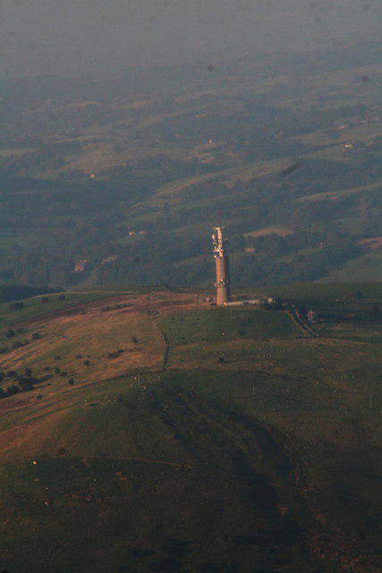 Photo could not load
SJ9367 : Sutton Common Telecommunications Tower: aerial 2015
Chris
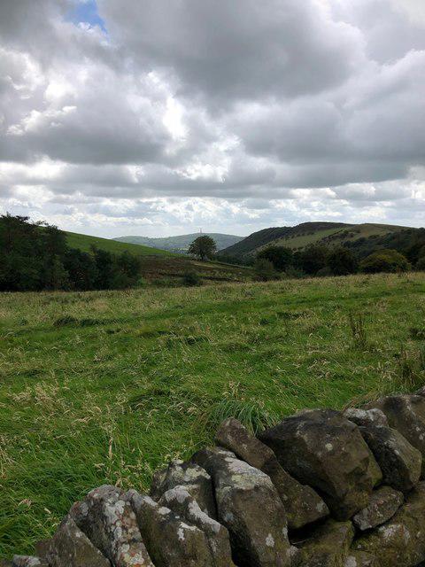 Photo could not load
SJ9367 : View down valley towards Tegg's Nose
Philip Cornwall
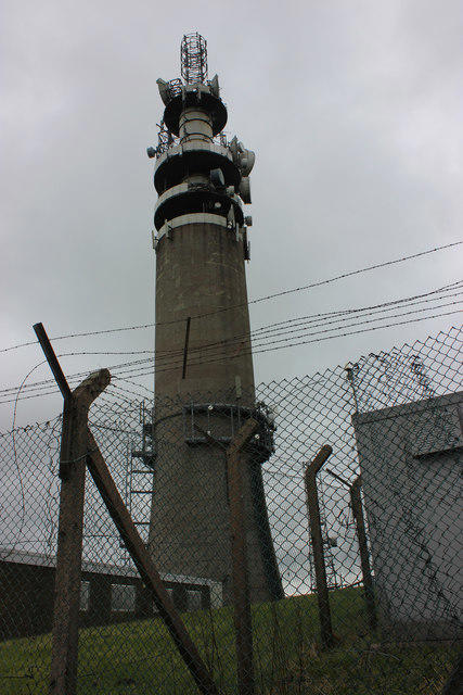 Photo could not load
SJ9367 : Telecoms tower, Sutton Common
Peter Turner
 Photo could not load
SJ9367 : Cold air inversion as seen from Cat & Fiddle - view to Croker Hill Communications Tower
Colin Park
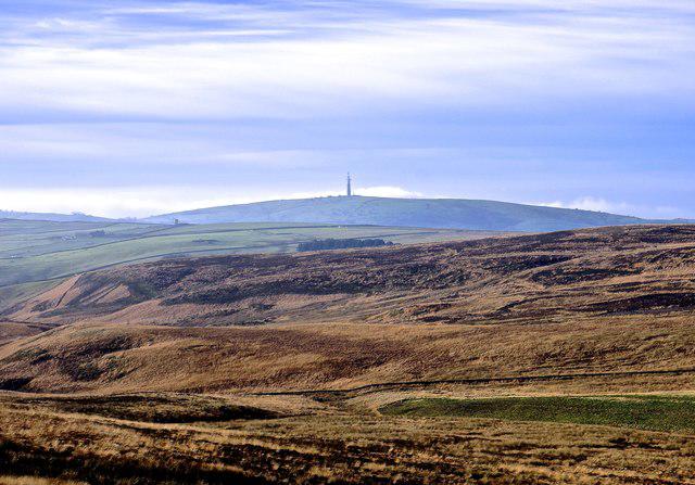
SJ9367 : Radio transmitter, Croker Hill
Anthony O'Neil
Hill facts and local notes
Classifications
Elevation
404m
1,326 ft
Prominence
95m
Coordinates
53.2063, -2.1005
SJ933676
OS Map
118
Explorer: OL24W 268S
At the Summit
The summit features a small cairn and a wooden bench, perfect for resting and taking in the views.
Terrain & Geology
The hill primarily consists of sandy soil overlaid by glacial till, creating an interesting mix of habitats that support diverse flora and fauna.
Views & Scenery
On a clear day, you can enjoy views of the Wrekin, the Shropshire Hills, and even the Welsh mountains to the west.
History & Heritage
Name Origin
The name 'Croker' is believed to derive from old Norse, indicating a place where croakers (water birds) were once plentiful.
Historical Significance
The hill has been a local landmark for centuries, historically used for grazing sheep and enjoying family picnics.
Getting There & Facilities
Parking
There is a free car park at the village of Sutton, approximately 1km from the trailhead.
Public Transport
The nearest train station is Congleton, approximately 8km away, with bus services connecting to Sutton.
Nearby Facilities
There are several cafes in Congleton, offering refreshments and restrooms.
Safety Information
Known Hazards
- Footpaths can be uneven, and care should be taken during rainy weather as the ground can get muddy and slippery.
General Safety Tips
- Check weather conditions before setting out
- Carry appropriate clothing and equipment
- Let someone know your planned route
- Take a map, compass, and GPS device
- Carry emergency supplies: food, water, first aid kit, torch
Hills
Some common questions about the hills answered
Are there group walks up Croker Hill [Sutton Common]?
Many walkers use Walkmates to join or organise walks with others. You can check for group walks around Croker Hill [Sutton Common] through the maps
Are there other walkers around Croker Hill [Sutton Common]?
Activity varies by location and time, but Walkmates lets you see whether others have shared walks or shown interest in this area. Find other people through the walking friends search walking friends for Croker Hill [Sutton Common] search or of course create your own walk for Croker Hill [Sutton Common]
Can I organise a walk to Croker Hill [Sutton Common]?
Yes. If there aren’t any walks listed already, you can create a walk and make it available for others to join.
If you're signed up to Walkmates, you can create a walk to Croker Hill [Sutton Common].
How do I find a walk up this hill?
There are often multiple ways to walk this hill, depending on experience and route preference. Walkmates helps you explore walks and routes that others have shared.
Can I suggest a new route up Croker Hill [Sutton Common]?
Yes. You can suggest or create routes to share with others. Walkmates focuses on the social side of walking, so routes are used to help people organise walks and explore areas together, rather than as detailed navigation tools or route libraries.
Other uses really appreciate knowledgeable walkers sharing their routes. Share your favourite route to Croker Hill [Sutton Common] here
The is an error or something incorrect about this hill. How do I let you know?
We always strive to keep the information on Walkmates as accurate as possible. If you find an error, please let us know through the contact form and we'll aim to correct it as quickly as possible
Community Discussion
Comments
Location
![Croker Hill [Sutton Common] location map](https://cdn.walkmates.com/hill-maps/hill-sources/7736/53.20630_-2.10053.png)
Grid reference: SJ933676
View on OpenStreetMapOpens a map in a new tab, centred on the hill.



No comments yet. Be the first.